The caravan park residents were well entertained when we decided to go and look at the cemetery; we have a strap that holds up the towing safety chains and whilst all the main gear had been disconnected the strap was left done up, on the car end of the tow hitch - wrong. We travelled quite a few metres with the van (kitchen extended and roof up, power cable spooling out but still connected) trundling along dutifully behind. Unfortunately the electrical cables got caught up and stretched so we had no turn indicators anymore. But where we were headed conformity with the road rules didn’t seem such a big deal. Camooweal is most interesting for the large lagoon on the Georgina River, which was just brimming with bird life. Brolgas, kites, duck by the hundreds, all were jostling for air space over this lovely lily covered place.
Our first steps out of town were along the Barkly Hwy west for 30kms or so, then we turned south on a minor clay track for Austral Downs Station that followed the Georgina 120kms, down to join the dirt Sandover Hwy where we would turn westward. Dark looking cloud lay over the horizon towards Alice some 700+kms away and my thoughts turned to what happens on this Queensland clay when it rains – you go nowhere for about a week!
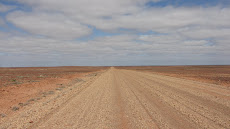
The landscape was immense and, apart from thinking of getting bogged, our spirits lifted as we moved further into the arid country. The threat of rain slipped away overhead as the day passed, and by the time we reached the Sandover, about midday, we were on familiar red sandy road and we pulled up across the road to shelter from the wind, while we made lunch. The occasional clapped out Ford wagon hurtled past with aboriginal people on board, headed for the Lake Nash community, where it was “sorry day” for someone who had died. As evening drew in we took a short side trip to see the Shotover River bed which had been a rushing torrent a few weeks before, but is now slowly flowing below the bed level. “Free” camping gives you a special sense of freedom, and we enjoyed a large fire that we lit beneath one of the radio masts that occur at about 100km intervals along the way.
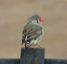
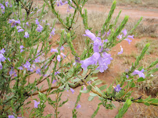
The following morning we were surrounded by bird life, mostly flocks of vivid green budgies along with sooty-coloured Wood swallows and Zebra finches galore. All the vegetation was beginning to flower so it was happy time for everything really!
 The Sandover Hwy was in good shape and we made good time, turning south again that afternoon on another back track leading to the Plenty Hwy. Our next free camp was near the Box Hole meteorite crater where we had another wonderful dinner under the stars all on our own. Then came the wide and braided Plenty River, with deep gravelly sand, a shallow pool to wade and a steep bank immediately after it. This was the only real challenge of the journey and we lowered the tyres to 15psi and dropped as many branches across the pool as we could find. All was well and with a short run and plenty of momentum the 1200kg rig was no problem.
 The corrugations were worse, but not an issue, as we turned west again on the Plenty Hwy, to duck off south again just 60kms later on the Cattle Water Pass Track. It was Saturday and nobody was around to ask about the conditions we were to face. There was a footy match on. We even drove three kilometres up a station driveway to find ourselves on an agricultural version of the Marie Celeste. So we bravely moved on to the track that takes you to a camp site at Old Ambalindum.
This is a 3600 sq. km property running 18000 Droughtmaster cattle. The track there was very hard work, over every sort of surface you can imagine, heading across the Harts Range, north east of Alice. We managed about 10kph average over the 60 kms, with many short and deep dry creek crossings, rocky sections and brief flat runs that would all occur within 50 metres. It was fun as well as challenging, and at the point when I began to see the van sliding sideways off the track I knew we were at the limit of what we should do. Afterwards we came across a notice at the Arltunga Information Centre telling travellers that they should under no circumstances attempt to tow a caravan of any description over that track, and a light weight box trailer just might get there. Nice to prove them wrong, but then bureaucracy always has to err on the cautious side.
We were running our supplies down and after the limited purchasing success at Camooweal, and with a week to go before flying back, Helen was being very inventive with the rice and lentils. What better way to cap off such excitement than to arrive at Old Ambalindum, thinking it was a ruin, to find a humming outback station with open arms extended to the travelling fraternity? First up, a team of surveyors who had been there for a month exploring for gold (very successfully apparently), and leaving the following day, asked if we would like to buy their unused diesel for $1:00 a litre – “fill her up” I said! Then, because we were such good customers, they brought over their remaining food supplies. Best rump steak, mince, salami, onions, oranges, tinned mushrooms....the list goes on and on. Top that with free firewood and an overdue and very welcome hot shower under the stars.
Old Ambalindum, in the MacDonnell Range and close to Ruby Gap, is where gemstones are literally picked up in the cattle yard. There are 800kms of private road on the place, and we were given a good map to explore with. The east to west boundary is 114kms long, so we spent a full day running through some glorious country with views of the Harts and MacDonnell Ranges to north and south, This was topped off by a scramble up lookout hill for a sunset drink before joining the campfire group for tall travelling tales. About 24kms from the station itself is Arltunga. This was an old and now derelict gold mining town that sprang up in the 1860’s, well before Alice Springs existed. Cornish miners and others, using local stone perfect for the task, built a collection of government funded buildings for the extraction of the gold, using a six head stamper battery, followed by cyanide and mercury treatment in tanks. It must have been a noisy and dangerous place to work, and lonely with the nearest town being Port Augusta about 1000kms south. Gold was discovered before explorer Stuart crossed the continent, just before the Overland Telegraph was set up in 1872. The Line brought pastoralists with it and in due course Alice Springs grew up at the main telegraph station. The South Australian Government then tipped money into expanding Arltunga and the government works were set up. Never very profitable though, it’s main contribution was to be the catalyst that brought support for the development of central Australia.
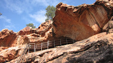
Now we could sense the nearness of a major centre. It was Queen’s Birthday weekend and there were a few town folk around, those who had not headed to the Finke desert races. Moving west now, we stayed at Trephina Gorge NP exploring N’Dhala Gorge nearby, where there is a wonderful walk through a “men only” gorge with many, many petroglyphs depicting the caterpillar dreaming. Images of fluttering butterflies abound. While still warm during the day we were getting cool at night, with a -2Celsius at Trephina to get us better adjusted to our return to winter. With a final bit of gorging at Emily and Jesse Gorges just out of Alice, we headed into town after lunch, to settle into a park and organise repairs to the van for our return in late July.
Alice is a beautiful town. Nestled at the Gap, a narrow break in the ranges where the Todd River has broken through, the landscape is possibly as fine as any city in the country. If it were not for intractable indigenous problems Alice could be a unique desert city in harmony with its environment.
 But from an architectural point of view there is unfortunately no local vernacular in the housing, rather more of the same project homes off the same tired “drawing boards”. However if you go to the oldest buildings that predate Alice itself, the Old Telegraph Station, you see sound, appropriate, well sited and fine buildings that should have been the basis for a beautiful local architecture. Ironic really. Very Australian.
 We met up with new chums Andrew and Prue again, who so warmly drew us into their circle of activity with a dinner with their colleagues and friends followed by some very powerful star gazing through Andrew’s self tracking telescopes, with a warming brazier to keep us from shivering. The van has been lodged at a remote private property outside town and the car is with A & P. We boarded QF 767 on Saturday, crossed the Simpson dusted with green, and a brimming Lake Eyre, with our noses glued to the Perspex, and here we are. Returning to a misty and dripping house to find everything as it should be, but even some more growth in the garden, is satisfying. Next step is Andy and Michelle’s wedding in Fiji next week!








fabulously informative - what a great trip you have been having - have been following your travels on Google earth. Am sure you will have a great time in Fiji - what a contrast. Love D & C
ReplyDeleteWhat a great read on a freezing wet afternoon down south. Rather rivetting on the track to Old Ambalindum. Nearly as exciting as the mudslides on my bike in horizontal rain and we now have grey thrushes on the porch singing love songs but nothing to compare to bower birds making eyes to the lady in blue
ReplyDelete