Friday, October 22, 2010

South from Alice via the Oodnadatta Track, and home

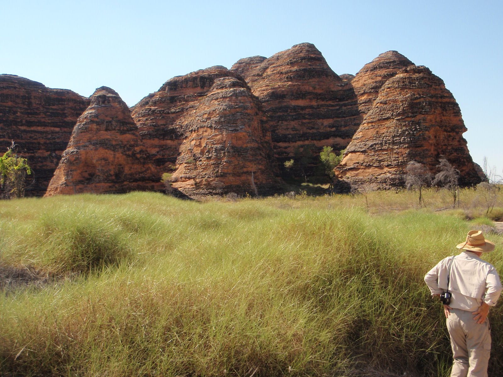
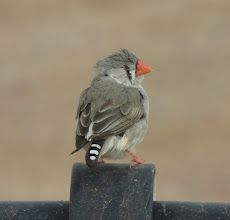
Re-capping from home now, and as always memories lose their edge and soften with time, but we had an interesting journey home from Alice. Wet weather had set in and our brief time with Jane and friend Hollis was spent chasing birdsong in slippery conditions. Hollis is a musicologist who uses particularly Butcher bird song as a starting point for her compositions. She has played at Carnegie Hall and other such places so takes the recording part very seriously. Along with birdsong she plays wire fences with her bow, and was tempted by one or two of the old cattle yard fences round about. An interesting pair are Hollis and Jane! Sadly we had to leave them as they settled in for the night along a remote riverbed, hoping for sunshine in the morning, and a grand early morning chorus.


We said good bye to the “G’day mate” caravan park, a cheerful establishment to which we will return, and made an early start down the road towards Marla, where you turn off onto the Oodnadatta Track, rumoured to be closed. The roadhouse at Marla had local artwork on display and we bought a third piece for Andy at a remarkably good price we thought. A squadron of mud covered cars and vans queued up for fuel so we bent their ears to find out what conditions were like. They had been holed up at Oodnadatta for four days along with dozens of others, due to the track being closed. They had exhausted all that the “village” had to offer within 24hours and had been stir crazy to get out. When these tracks are closed though, they mean what they say. Anyone caught wilfully breaking the closure is rigorously fined on the basis of $1000 a wheel. The tracks are mostly clay based and after 5mm of rain you are sliding about; 10mm has you digging deep ruts and destroying the road surface, making it undrivable when it does dry out because the tall ridges so made are as hard as concrete. The word was that the track was still closed between Oodnadatta and William Creek, so we embarked on a zig zag course tacking upwind, Marla-Oodnadatta, Oodnadatta-CooberPedy, Coober Pedy-William Creek. Yes, a long way when you could just drive south down the Stuart Highway and do half the distance and mostly on bitumen. This back-of-beyond mentality has its costs, but it’s like a good social drug. 


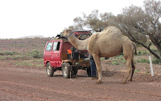
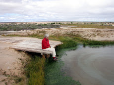
After a night beside the track we renewed acquaintance with the Pink Roadhouse in Oodnadatta, up for sale since early in the year – as its remarkable owner Lynnie Plate said: ”no-one is as crazy as we were all those years ago”. Shortly afterwards we stopped for a chat with traveller Klaus who spends his life walking beside his camels towing a cut-off Hilux van - he would be in Cooper Pedy in 10 days, us in a couple of hours. He was very happy to be given a pair of Ian’s runners. (Google Klaus and camel!)

As we left Coober Pedy at 16:30hrs we knew  we would be driving on dirt for at least an hour or so in the dark, something we have avoided in about 50,000kms of outback driving. Sure enough spots of rain began to fall as dusk enclosed us, with at least 100kms still to run into William Creek. The road though was beautiful and smooth, obviously none of the rain had fallen over this country for a while. I said to Helen “this is too good, I’ll bet something crops up before we get there”, and sure enough it did! Pitch dark and a car pushing behind us 200 metres back, A gentle bend in the road with a track off to the left that had my attention. Deep muddy ruts developed out of nowhere and then standing water. Just not enough time to observe it properly before we were committed. The safe track wound off to the right through trees but we were in to it already. I had cleaned the car and van in Alice knowing it was a foolish enterprise, but you feel better with a clean rig. Well, not any more as we emerged well coated from top to bottom. The glimmer of a few lights that is William Creek by night was very calming and it took no time at all to decide to prop up the bar for an hour by way of recovery. Small world. The proprietor behind the bar was wearing an apron with “Redesdale Camp Oven Cook Off” emblazoned across the front of it. Her last pub was one of our locals!

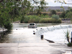
The bit was firmly clenched between the teeth now, and even Helen agreed we should press on with much haste. An early start next morning and we reached William Creek proper about a quarter of an hour out of the hamlet. We had been warned that this was the only real watery obstacle on the southward run down the Oodnadatta Track. Five minutes of careful evaluation and mud probing of possible alternatives and we realised there was no alternative but to “go for it”. This was the creek that had snaffled one of the many travellers who were still trapped in William Creek pub. We met him at the phone booth and he introduced himself as “the one who drowned his car and was on the news”. Clearly things had not gone well for a lot of folk during the previous rainy spell. So we took this 30 metre wide stretch of deep muddy creek seriously. Much care was called for along with some good entry speed and plenty of revs. The Vista weighs 1100kgs so clear heads were called for.

When you have made up your mind you get this “just do it” feeling, so we clambered aboard and set off with hearts pumping and adrenalin flowing. Gee it seemed deep and we didn’t have enough speed on before we were dropping deep in. The van felt heavy and I had to turn the steering wheel side to side to keep purchase and to keep moving. Helen shrieked “come on car, come on”, whacking it like a horse. The far side seemed to take forever to come closer but with wheels spinning and mud flying everywhere, hot smells of oil and engine in the cabin, we knew we’d make it. I stopped on the far side and we took stock, winners are grinners, but I knew something was wrong as I looked down and realized the hand brake was still on!
You have to laugh don’t you!

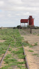
The rest of the day was spent revisiting (since our first trip in 2008) the Track’s highlights and Ghan history, eg Strangways Springs with its pastoral and Telegraph station ruins, rail sidings like Curdimurka, artesian mound springs, Lake Eyre South, finally arriving in Maree, home of Tom Kruse the Birdsville mailman. Onwards south beside the Flinders Ranges, and after a magnificent drive in the dusk through the Arkaba Hills we camped at Rawnsley Park

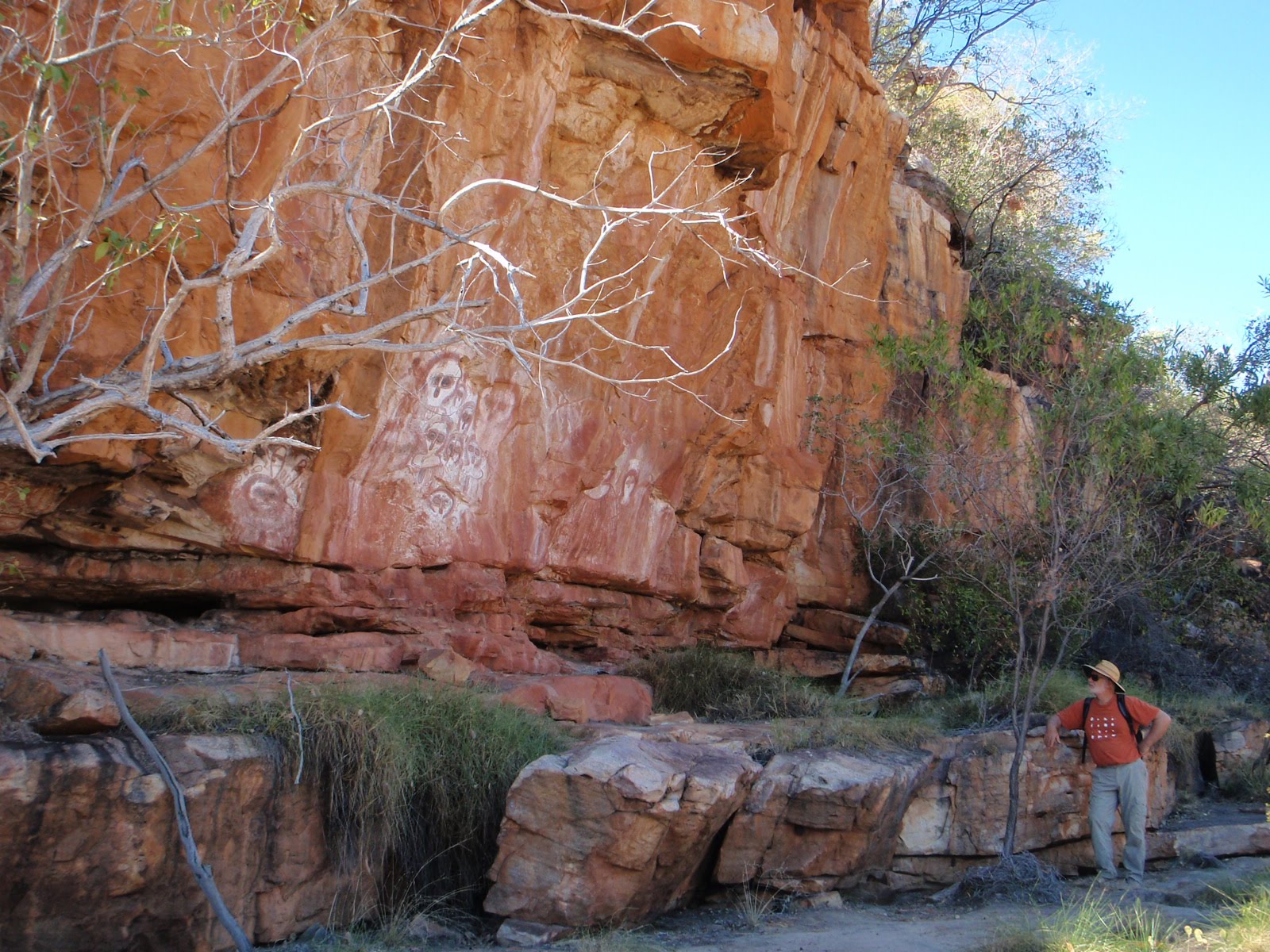
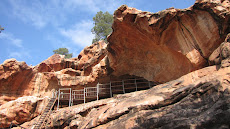
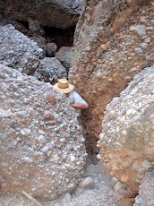
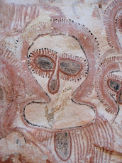
Next morning’s treat just out of Hawker was three art sites in Yourambulla caves with paintings mostly of manganese, charcoal, red or yellow ochre. South Australia’s broad acre grain plains are dotted with the beautiful stone ruins of once smaller farms, like this one near Peterborough. Covering the ground smartly through the Riverland irrigation and fruit areas along the Murray, we camped on Saturday night (28 August) in one of the Chowilla camps in mallee conservation areas over the border in NSW. A 5am start next morning put us on a beautiful drive to Wentworth through mallee and desert country with decent roadside remnant vegetation. After paying homage to the junction of the Darling and Murray rivers at Wentworth we headed for breakfast at Stefano’s cafĂ© in Mildura. This set us up for the less interesting drive down the Calder Highway to reach home by 5pm. What joy to see the place looking gorgeously green, grass trimmed by the ‘roos, and bulbs awaiting our arrival before flowering. Better still, the weeds had been held at bay by the cold, wet winter. Not for long though – we have been waging war on Capeweed and gardening during September and October, a partial excuse for not finishing the blog until today!

Tuesday, August 24, 2010

Alice once again

How good it is to be back in Alice Springs with always more to do and see. We have well-supported the Alice economy on each of our visits, especially fix-it outlets: this latest with the purchase of an expensive electrical invertor to replace the one that died, of irresistible books at Red Kangaroo bookshop and of course the dreaded Coles supermarket and liquor outlet. Another lunch at the Olive Pink Botanic Gardens cafe noting the Bower Birds extra nest decoration (plastic clothes pegs), a visit to the arts centre at Araluen to watch a moving video about Geoff Bardon and the birth of the Papunya Tula art movement, a drive south to the Rain Dreaming rock carvings at Ewaninga (right).


A couple of days in the MacDonnell Ranges Big 4 caravan park was quite enough after shelling out $43 per night – admittedly the loo paper was superior, and irons were laid on should sartorial splendour be required; we wore freshly ironed shirts for the election night party! So when we discovered the “bird ladies” were booked in over the road at G’day Mate we inveigled our way in to this delightful small park for $30. Little did it know it was to host a splendid party in our slot behind the shed to welcome Jane and violinist Hollis, who chases Pied Butcher birds all over the inland to record their polyphonic calls for her post-doctoral work. As luck would have it, our friend Andrew Crouch’s ornithologist father had recorded birds (including the Butcher bird) and his work was known to the bird ladies, so Andrew dropped in to meet them and swap stories and CDs. Despite a disgraceful array of empty bottles, Hollis as usual arose at 3am to record this musical bird. 

After the past couple of days of rain and on the strength of a report of vans stranded on the Oodnadatta Track, we decided to stay another night in Alice and accompany Jane and Hollis out to the Owen Springs Reserve, NT’s first pastoral station, with homestead ruins dating to the 1880’s, and bought by the NT government in 2003. After watching them record fence music we left them after lunch in a drizzle, to camp along the Hugh River to continue their quest for birdsong. Ian and I continued the 50 km loop through mud and sandy river beds with a view of Redbank Waterhole and its lovely empty campsites, back to the Stuart Hwy into Alice in time to get to the video shop. We feel brave enough to watch Wolf Creek for the first time, having survived a visit to the crater on our way up the Tanami a few weeks ago. (PS the movie was horrific and we had to have pizza to recover).

So tomorrow it seems we finally leave and head down the Stuart Highway bitumen for 400km or so to Marla, and maybe miracles will happen to dry the Oodnadatta Track enough to re-open.  Awaking this morning to a text message from our mate Terri with pictures of my bulbs flowering is spurring the homeward journey.

Monday, August 23, 2010

Tanami return


Our first night back on the Tanami on the 19th was pure magic. We detoured the 40 kms into Balgo community to look at the art centre there. Unable to help ourselves and realising that one piece hanging on our wall would be incongruous, another modest purchase was made. The creative director Annette knew that at that late hour we would have nowhere to stay so she took us off out of the settlement to the edge of a cliff in the Balgo Hills. The view out across a 50 kilometre broad plain (once an inland sea complete with fossils) a hundred metres below us, washed by evening sunlight and edged all around by an escarpment, was really a special experience few white folk get to see. Camp here for the night she said. And we did. Check out this photo.

The Tanami was again lovely when you stop, turn off the motor and just listen to the birdsong and take in the variety of plant life. A month has made a wonderful difference in the flowers after our first trip up. On our second night we camped behind Renehan's Bore near this wrecked vehicle - a common sight, but H was more thrilled by the botanical variety. This year is unusual after so many drought years, but it would be wonderful if better rainfall were to happen more regularly. Is this part of the southward trend of tropical weather systems associated with climate change? Oh, shut up! Two years ago the Oodnadatta Track was as dry and bare as it could be and it will be interesting to see it again this year as we make our way into South Australia in a day or two’s time. So we are again in Alice, a complex place but fascinating and beautiful. Could have lived here in another life I think. We meet up with old friend Jane Ulman tonight, who is arriving to spend time recording birdsong for the ABC. Alice is a meeting place in more ways than one.

Sunday, August 22, 2010

Purnululu NP (The Bungle Bungles)

On day eight we realized “It was time”, and the urge to make tracks again was unavoidable. Not least because our van battery was nearly dead so we had to drive to bring it to life again. We said our good byes and took the bitumen road towards Halls Creek, next port of call the Bungle Bungles, or more correctly Purnululu NP. Our first night out, courtesy of Brian’s local knowledge, was a fine water hole on the Bow River where bird life was beautiful to watch (eg the ever present Rainbow Bee-eater) as was the ant life at our feet! It was hot too, and we were glad of an early start the next morning and the climb up to higher ground and cooler air above 300 metres. Temperatures were up in the high 30’s now, and quite humid with some locals saying the “The build up” may be starting (three months of rising humidity and temperature before the rains arrive). After a brief stop to see the Aboriginal Art Community at Warmun (art began there when famous artist Rover Thomas first put paint to board), we reached the turn off at Mable Downs Station, dropped the tyre pressures and headed the 53 Kilometers and two hard hours towing over the Osmand Range into the park itself.

Purnululu is a World Heritage place, and deservedly so. We flew over the area two years ago (see our 2008 blog link top left) and were staggered at the unique rock formations there. Anyone who sees photographs would ask themselves “how did that come about”, so here is a brief explanation and please forgive the tutorial. The Osmand Range is 1.8 billion years old. Through glaciations and high erosion massive quantities of river rounded stones and rocks were washed from the eroding range into a basin and accumulated to a depth of about 300 metres, forming a largely homogeneous conglomerate about 360 million years old. The range was then uplifted and that induced lines of weakness in the deposited conglomerate, fracturing it into regular blocks. Normal weathering has now reduced these blocks into 300 metre high domes, almost too numerous to estimate. In the southern end of the park 30 kilometres distant, the conglomerate was regularly interspersed with layers in which more clay is present. These clayey layers hold slightly more water, allowing cyanobacteria to survive in these layers and produce a coating that leads to more resistance to weathering. So these metre or so thick layers stick out more and are darker. The effect is a dome just like a classic beehive (I’ve never seen one but perhaps in biblical times?).

Equally surprising is that this extraordinary formation was not really known to white Australians until 1982, when a documentary making team were in the vicinity and overheard a mustering helicopter pilot describing these strange domes to a mate in the bar. He flew them into The Bungle Bungle Range the next day; they scooped the pool and started a tourist rush that has changed the whole local economy. Seeing the place on foot limits you to a minimum of short walks that doesn’t begin to scratch the surface; an overnight walk up Picanninny Gorge is an option. But it is enough to experience clefts and chasms I doubt are equalled elsewhere, such as Echidma Chasm left, which narrows to a one person space. We had two nights there and by dint of early dawn starts managed to experience all of the sites on our own, avoiding the bus parties and the 36 degree heat of midday.


Out of Purnululu now, heading resolutely south, and sensing a return to home and hearth, albeit still a few thousand kilometres away. Halls Creek is a town with a reputation that must be updated. Reports were not favourable, but we found a delightful small town where we could re-provision before starting our southerly journey in earnest, back down the Tanami Road to Alice Springs. Our travelling Jones buddies had given us a tip to go to Caroline Pool about fourteen kms east of the town, where we found, again, a wonderful camp spot for the night, all on our own.We had toyed with the idea of
heading north west via the Buntine and Buchanan roads and joining the Stuart Highway north of Tennant Creek. This would have avoided a repeat of the Tanami but would have been an extra 700kms and most of that on bitumen – not our favoured surface. More to the point we had to make sure we got ourselves in front of a TV screen on election night! We are very fortunate in having friends in interesting places - our new Alice Springs friends Prue and Andrew took us along to a great 50th cum election party. As you might have an inkling how we vote there is no need to make even passing reference to that night (though the company at the party was great!) except perhaps to suggest this could be the shake-up that politicians on both sides need. Go for it Bob! 
 

Friday, August 20, 2010

Kununurra

Kununurra is a town you can comfortably while-away time in, when the weather isn’t too hot of course. With our camp set up beside the edge of the lake, and the town close by, we could do our chores in relaxed style and kept extending our stay to a week.  Replacing the tyre was no problem, although there is much criticism of Cooper tyres up here with claims that they are not adequate to cope with the heat. Consensus is that BF Goodrich are as good as you can get, and you pay the price accordingly, so BFG’s all round next time. The Beveridges came for dinner on the lawn on the Wednesday, made feasible after about 8pm when the midges seem to get exhausted. Those who have followed our blog may recall we met up with the Jones’s as our paths crossed in Alice, early this year. And so those paths crossed unexpectedly again. At dinner we had a call and sure enough it was Max with the message they were in the Kimberleyland caravan Park in Kununurra with more car trouble, wondering where in our great southern land we were. They were five van sites east of us! It can be difficult slotting in alcohol-free days with this idle swanning around.


We took a day to visit the remote cattle shipping town of Wyndham on the Cambridge Gulf again (last there in 2008), and enjoyed a beer and sandwich on top of The Bastion, from where you get a panoramic view of five rivers coming together at the one Gulf (Ord, Pentecost, King, Durack and Drysdale).Must be an extraordinary sight in The Wet. Wyndham is also famous for its huge but made-to-scale saltie statue. Another day we headed east early in the day, crossing into the Northern Territory to find the rock art at the north end of Keep NP, and then back into WA to go to Lake Argyle Village to cast our votes at the early polling station that was there for all of three hours. With a remote family connection to the construction of the dam that created the lake, Kununurra and the irrigation industry beyond, we again enjoyed watching the video showing the construction works as they progressed, hoping we’d be able to catch a glimpse of a young Bobby Keath on a piece of heavy machinery. From our campsite in Kununurra we had watched distant fires throwing a glow into the night sky beyond the hills. At Lake Argyle much of the countryside was burning right up into the rocky outcrops, and all to no purpose – probably arson, a common problem largely the result of disaffected youth, or so we are lead to believe.

One of the Kununurra Dragon boat crew had previously spoken of a fellow she knows well who is full bottle on Bradshaw rock art; she thought she might be able to get him to give a presentation. And so it turned out. On the Thursday evening after our Argyle visit, we all met at her house about ten kilometres out of town, for a wonderful presentation by Ricardo Rowe. How small the world is. As soon as we set eyes on Ricardo we realized he was unmistakably the brother of our near neighbor and long term friend Clive Rowe on Mt Macedon! Our understanding of the Bradshaws and the politics surrounding them was greatly increased (and what controversy there is), and also through a book by Tim Wilson called “The Lost World of the Kimberley”, we have been inspired to find out more and help make the proper management of what should be a world heritage area a reality, if we can. Anyone want to know more? Please ask.

One of the special pleasures in Kununurra is the local Aboriginal Art Centre called Warrangarri, where we were unable to resist our first purchase any longer. We have found this artwork striking in many ways but have not felt confident in our judgement, especially being aware of exploitation and fraudulent work that has been occurring in some places. The community based centres, and there are many through the centre and north (Papunya Tula, Yuendumu, Warmun, Warrangarri and Balgo amongst the longest established), are organized corporate structures having aboriginal Boards of Directors that employ western teams to manage the production and marketing of the work for the benefit of the artists directly. Purchasing work at these places ensures there is no middle man and the money goes where it is most needed. Artwork is priced by size and by seniority and this was common where we visited. More on this topic later.

Wednesday, August 11, 2010

East Kimberley to Kununurra


After Mt Elizabeth where we spent four nights, we began to think of our friends residing in Kununurra at the east end of the Kimberley, so we set off early on a long day to reach Home Valley (where the film "Australia" was made), just 70kms from the bitumen and 120kms from Kununurra. There is a Grollo owned property called Ellenbrae 5kms off the road, where good scones can be had, or tyres can be repaired. We shredded a tyre after putting a stone through it about twenty short of the scones, and took two hours changing it because we couldn't get any of our three jacks to fit under the lowered undercarriage, and ended up digging a deep hole in the road to get the tyres off and on again! Don't blame me if you hit a deep pot hole! We reached Home Valley safely enough but it is nerve racking driving without a spare when you realise none of the tyre mending technology you are carrying is any use at all. By the time we reached Home Valley there were seven with tyres written off; one had had three go in a short distance. Luck has somethng to do with this but tyre pressures and speed a lot too. The road had been topped with crushed shaley metal since we were last on it, and the result is a very happy local tyre industry. This morning at Tyrepower I heard of a new Range Rover owner who had done 5000kms in his pride and joy when it broke down out there. The owner was heard talking to the Sydney dealership whilst stuck at the roadside "....and I've just been passed by a f.....g Wicked van!" Apparently he purchased a new Toyota LandCruiser in Kununurra to continue his journey. Oh what a feeling!

Kununurra has been wonderful and in large measure because we have been able to catch up with old friends and one time client Brian and Greta Beveridge. We left Home Valley early so we could reach K in time to have a catch up and prepare for crewing on the Ord River Dragon Boat, Brian being the VP of the local dragon boat club. It's great to be able to meet local people like this, and take part in some of the social activity. Saturday morning had us on the lakeside at 0700hrs clambering into three canoes that Brian and Greta own, then paddling out through lily lagoons onto the broad sweep of the Ord itself, and a couple of kilometres downstream to The Old Pump House for a stunning breakfast. 

A little exhausted, we rested up until 1400hrs, then set off with Brian's local knowledge to a rock art site out of town. It was extraordinary in every sense. About 300 metres of overhung rock face at the base of a towering range that resembled the Bungle Bungles. There is a wide range of art, but also much evidence of spear tips, grinding rocks and the grindstones, and especially whole rock faces where spears had been sharpened over many generations. We returned for Barra and chips that night well satisfied with a marvellous day.

Tuesday, August 10, 2010

West Kimberley

It was a delight to meet up again, and to share the family stories from the past year. Our plan was to be up at 0500hrs next morning and drive to the radio shack where the Mornington Station road departs the Gibb River Rd. Their office opens at 0730, so people queue at the radio as early as possible to be advised if they can proceed the two hours drive that it takes to get to the place. We were head of a group of about six wanting access. The journey in started with some excitement when out of the dust cloud ahead I saw Bill running back towards us, arms waving and fingers pointing. There on the side of the road and in danger of being driven over, was the largest King Brown snake (the only King Brown snake) we have seen. It WAS big, and of course everyone pulled up behind us wanting to take photographs of one of Australia's most aggressive and poisonous snakes. As the Tvan owner drove past it had a good lunge at the tyres. Bill is a bushman and just wanted to make sure noone drove over the snake, but I think some amongst the group might have thought the best thing would be to do just that!

Mornington Station is now owned privately by the Australian Wildlife Conservancy Trust, and has
been for some years now. Until the 1990's it was one of the larger cattle stations and had been run that way for many decades. Now it has been mostly de-stocked and great efforts are being made to measure and evaluate the country as it reverts to something closer to its proper state. There is no doubt that cattle destroy this fragile country, miring the waterholes, spreading weed species, and eating out the native and more succulent grasses. The AWC activity takes place alongside tourism, and they make the most of the education opportunity this offers. They do things differently and run programs that help establish better ways of managing. A good example we saw is feral cat control: cats being responsible for most of the native species destruction. Where pest management on surrounding cattle stations focuses on killing dingoes, at Mornington the dingoes are tagged and numbers encouraged because they are the only natural predator the cat has. At Mornington native species are bouncing back. Fire management is another example of applying a different philosophy and coming up with beneficial results.

Mornington has many delights, amongst which is the Dimond Gorge - a broad gorge on the
Fitzroy River that arguably surpasses even Katherine Gorge in the Northern Territory. We took a couple of canoes for the day to enjoy our lunches up stream. Three nights we had there, and as our fridges began to play up (not being on mains power) and supplies were running low we had a final special birthday dinner at the excellent restaurant under the stars, to celebrate Helen's 64th. Not many better ways to spend a birthday.


Getting fuel on the Gibb can be interesting, and the word was that Mt Barnett Roadhouse had
run out, so we back racked 25kms and refuelled at Imintji aboriginal roadhouse.This gave us enough range to do the various side trips that are on offer when you stop at the privately owned properties. We parted company with our dear friends and only four kilometres past the radio shack turn off to Mornington we turned off northwards to Charnley River Station. This is a "traditional" cattle property with many kilometres of good private roads and several gorges and waterholes, some with examples of rock art that had Helen's blood pressure up. There were two young helicopter pilots there, one a very shapely (what a lovely term!) 30 year old blonde woman, the other her partner? We were woken at 0530hrs as they each warmed up their helicopters, and in synchrony blasted their way through the camp ground a couple of metres above the ground at about 100 knots, before soaring up over the trees two hundred metres away and off for a day’s mustering.....as you do.


We had two nights there and then eased our way further east to Mt Barnett and Manning Gorge. This is a spot I don't know how we missed two years back. We were able to top up with fuel and then went the few kilos to the Manning Gorge camp site - large and many many people camped there. It was a delight to find John and Del Cutler and their two boys who we had met back at Lawn Hill earlier in the first part of our tour. We pitched up next to them and shared the journeying over a fine Del risotto. The gorge is a sensation and well worth the broad creek boat crossing and hour walk to get there. There is even a little Gwion Gwion rock art if you have your eyes peeled. Large numbers of happy campers get a bit ordinary so after our walk with John & Del we packed up and moved into Mount Elizabeth Station 60 kms further east.


 Owned by the Lacy family since first settled in 1946, this property again runs cattle, but is largely destocked due to the poor wet season in the west Kimberley this year, and the state of the beef market. We were especially grateful for the opportunity to see some wonderful rock art, similar to that we saw two years ago at King Edward River further east. There are rock holes and waterfalls with sandy beaches that frankly better any holiday resort. And we were fortunate to be the only people at all of the lovely spots we visited. These private places are good because, whilst they are some kilometres from the main road, numbers are low.

Back on the road from Alice to home....eventually.

Wedding break

Chopping the tour into two parts, so that we could celebrate Andy's wedding in Fiji in July, has proven to be a great success. Once we had organised secure places for us to leave the car and the van (in separate spots in Alice) we flew off feeling slightly disembodied, as the plane lifted up and up over the Simpson Desert and views of Lake Eyre, heading for Tullamarine. Katie met us and took us home and we had much to catch up on with our gallery-owning daughter. We had a fortnight at home during which time we were able to make contact with friends at the Newham Winter Dance, sort the post and pour a witches brew of nutrients onto the garden to improve weed resistance - all good creative stuff.

Andy's wedding was organised entirely by them on Treasure Island, Fiji. We met Andy and the bride's family at the airport and set off for a week, at the conclusion of which Michelle Travers became Michelle Scott and Andy a very happy chappy. Kate came out for a couple of days and we were all together having a lovely family affair.


Tanami Road

There has been a lot of rain through the centre this season, and many roads have been closed. Our plans to meet up with friends at Mornington Station at the west end of the Gibb River Road were very much dependent on the Tanami Track, running north west out of Alice, being open. We headed up there the day it was officially reopened, and had no trouble at all. Rabbit Flat has been an iconic stopping place on the Tanami, where fuel can be had provided you arrive between Friday and Sunday evening. The proprietor Bruce arrived there forty years ago with his newly-wed French wife Jacqueline, sunk a bore, planted an orchard, and they have been the only white occupants of the country there for hundreds of kilometres. Sadly as with all things they will be closing down at the end of the year, and many travellers will have to make other arrangements. End of an era. 
Apart from a fairly chopped up road at The Granites where there is a lot of new mining activity, the Tanami was good. The references seem to be unanimous in saying the Tanami is a boring road, but we didn't find it so at all. Helen found the plant diversity endlessly fascinating, and old mine sites are always interesting. Two days driving and we were at Wolfe Creek Crater just short of the junction with the Great Northern Highway west of Halls Creek. Wolfe Creek Crater, 800 metres across, is a relatively recent crater at 300,000 years old. It was first “discovered” in 1947 when a survey team flew over it looking for minerals. It seems extraordinary to realise that these stretches of country that are now so busy with tourist activity were unknown when Helen and I were born!


When we left the Tanami we pumped up the tyres for the bitumen and headed west as quickly as we could, aiming for Fitzroy Crossing 274 kms away, where we briefly detoured to Geikie Gorge. Forty three kilometers west of Fitzroy Crossing we turned north on dirt again, on the Leopold Downs Road. This takes you past the Devonian Reef NP, to Windjana Gorge NP, where we pitched up for the night. We visited Windjana in 2008 and were pleased to make a brief reacquaintance with the place. Bill had purchased the same sort of steam driven satphone as we have, so after much frustrating pointing of devices at satellites and really by a fluke, we made contact with each other and discovered they were on the other side of the Leopold Ranges at Silent Grove, awaiting our arrival. A brisk early morning walk up the gorge to see the fresh water crocodiles and off again, to make the remaining 135 kms in time for hot breakfast coffee with Bill and Jill.

Tuesday, June 22, 2010

Camooweal to Alice

This last stage of our journey, which ends the first part of this year’s tour, has been everything a holiday on the move should be. We are grinning from ear to ear. Camooweal is a so called suburb of Mt Isa, being administered from the mining town. That makes the 200km road joining the two places the world’s longest main street, and of course Camooweal makes the most of it. On that basis we had assumed a decent supermarket for restocking, but no, the postman drives every day into Mt Isa to collect the mail, and also the day’s supplies for the shop! But we bought up as best we could in preparation for a long sojourn “out of range”.

The caravan park residents were well entertained when we decided to go and look at the cemetery; we have a strap that holds up the towing safety chains and whilst all the main gear had been disconnected the strap was left done up, on the car end of the tow hitch - wrong. We travelled quite a few metres with the van (kitchen extended and roof up, power cable spooling out but still connected) trundling along dutifully behind. Unfortunately the electrical cables got caught up and stretched so we had no turn indicators anymore. But where we were headed conformity with the road rules didn’t seem such a big deal. Camooweal is most interesting for the large lagoon on the Georgina River, which was just brimming with bird life. Brolgas, kites, duck by the hundreds, all were jostling for air space over this lovely lily covered place.


Our first steps out of town were along the Barkly Hwy west for 30kms or so, then we turned south on a minor clay track for Austral Downs Station that followed the Georgina 120kms, down to join the dirt Sandover Hwy where we would turn westward. Dark looking cloud lay over the horizon towards Alice some 700+kms away and my thoughts turned to what happens on this Queensland clay when it rains – you go nowhere for about a week!
The landscape was immense and, apart from thinking of getting bogged, our spirits lifted as we moved further into the arid country. The threat of rain slipped away overhead as the day passed, and by the time we reached the Sandover, about midday, we were on familiar red sandy road and we pulled up across the road to shelter from the wind, while we made lunch. The occasional clapped out Ford wagon hurtled past with aboriginal people on board, headed for the Lake Nash community, where it was “sorry day” for someone who had died. As evening drew in we took a short side trip to see the Shotover River bed which had been a rushing torrent a few weeks before, but is now slowly flowing below the bed level. “Free” camping gives you a special sense of freedom, and we enjoyed a large fire that we lit beneath one of the radio masts that occur at about 100km intervals along the way.

The following morning we were surrounded by bird life, mostly flocks of vivid green budgies along with sooty-coloured Wood swallows and Zebra finches galore. All the vegetation was beginning to flower so it was happy time for everything really! The Sandover Hwy was in good shape and we made good time, turning south again that afternoon on another back track leading to the Plenty Hwy. Our next free camp was near the Box Hole meteorite crater where we had another wonderful dinner under the stars all on our own. Then came the wide and braided Plenty River, with deep gravelly sand, a shallow pool to wade and a steep bank immediately after it. This was the only real challenge of the journey and we lowered the tyres to 15psi and dropped as many branches across the pool as we could find. All was well and with a short run and plenty of momentum the 1200kg rig was no problem.

The corrugations were worse, but not an issue, as we turned west again on the Plenty Hwy, to duck off south again just 60kms later on the Cattle Water Pass Track. It was Saturday and nobody was around to ask about the conditions we were to face. There was a footy match on. We even drove three kilometres up a station driveway to find ourselves on an agricultural version of the Marie Celeste. So we bravely moved on to the track that takes you to a camp site at Old Ambalindum.
This is a 3600 sq. km property running 18000 Droughtmaster cattle. The track there was very hard work, over every sort of surface you can imagine, heading across the Harts Range, north east of Alice. We managed about 10kph average over the 60 kms, with many short and deep dry creek crossings, rocky sections and brief flat runs that would all occur within 50 metres. It was fun as well as challenging, and at the point when I began to see the van sliding sideways off the track I knew we were at the limit of what we should do. Afterwards we came across a notice at the Arltunga Information Centre telling travellers that they should under no circumstances attempt to tow a caravan of any description over that track, and a light weight box trailer just might get there. Nice to prove them wrong, but then bureaucracy always has to err on the cautious side.

We were running our supplies down and after the limited purchasing success at Camooweal, and with a week to go before flying back, Helen was being very inventive with the rice and lentils. What better way to cap off such excitement than to arrive at Old Ambalindum, thinking it was a ruin, to find a humming outback station with open arms extended to the travelling fraternity? First up, a team of surveyors who had been there for a month exploring for gold (very successfully apparently), and leaving the following day, asked if we would like to buy their unused diesel for $1:00 a litre – “fill her up” I said! Then, because we were such good customers, they brought over their remaining food supplies. Best rump steak, mince, salami, onions, oranges, tinned mushrooms....the list goes on and on. Top that with free firewood and an overdue and very welcome hot shower under the stars.

Old Ambalindum, in the MacDonnell Range and close to Ruby Gap, is where gemstones are literally picked up in the cattle yard. There are 800kms of private road on the place, and we were given a good map to explore with. The east to west boundary is 114kms long, so we spent a full day running through some glorious country with views of the Harts and MacDonnell Ranges to north and south, This was topped off by a scramble up lookout hill for a sunset drink before joining the campfire group for tall travelling tales. About 24kms from the station itself is Arltunga. This was an old and now derelict gold mining town that sprang up in the 1860’s, well before Alice Springs existed. Cornish miners and others, using local stone perfect for the task, built a collection of government funded buildings for the extraction of the gold, using a six head stamper battery, followed by cyanide and mercury treatment in tanks. It must have been a noisy and dangerous place to work, and lonely with the nearest town being Port Augusta about 1000kms south. Gold was discovered before explorer Stuart crossed the continent, just before the Overland Telegraph was set up in 1872. The Line brought pastoralists with it and in due course Alice Springs grew up at the main telegraph station. The South Australian Government then tipped money into expanding Arltunga and the government works were set up. Never very profitable though, it’s main contribution was to be the catalyst that brought support for the development of central Australia.

Now we could sense the nearness of a major centre. It was Queen’s Birthday weekend and there were a few town folk around, those who had not headed to the Finke desert races. Moving west now, we stayed at Trephina Gorge NP exploring N’Dhala Gorge nearby, where there is a wonderful walk through a “men only” gorge with many, many petroglyphs depicting the caterpillar dreaming. Images of fluttering butterflies abound. While still warm during the day we were getting cool at night, with a -2Celsius at Trephina to get us better adjusted to our return to winter. With a final bit of gorging at Emily and Jesse Gorges just out of Alice, we headed into town after lunch, to settle into a park and organise repairs to the van for our return in late July.

Alice is a beautiful town. Nestled at the Gap, a narrow break in the ranges where the Todd River has broken through, the landscape is possibly as fine as any city in the country. If it were not for intractable indigenous problems Alice could be a unique desert city in harmony with its environment.
But from an architectural point of view there is unfortunately no local vernacular in the housing, rather more of the same project homes off the same tired “drawing boards”. However if you go to the oldest buildings that predate Alice itself, the Old Telegraph Station, you see sound, appropriate, well sited and fine buildings that should have been the basis for a beautiful local architecture. Ironic really. Very Australian.

We met up with new chums Andrew and Prue again, who so warmly drew us into their circle of activity with a dinner with their colleagues and friends followed by some very powerful star gazing through Andrew’s self tracking telescopes, with a warming brazier to keep us from shivering. The van has been lodged at a remote private property outside town and the car is with A & P. We boarded QF 767 on Saturday, crossed the Simpson dusted with green, and a brimming Lake Eyre, with our noses glued to the Perspex, and here we are. Returning to a misty and dripping house to find everything as it should be, but even some more growth in the garden, is satisfying. Next step is Andy and Michelle’s wedding in Fiji next week!

Wednesday, June 9, 2010

Burketown to Lawn Hill, Riversleigh and Camooweal

The Savannah Way, running all the way from Broome in the West (WA) to Normanton and on toCairns on the east coast, is a wonderful road that takes in some of the most exciting scenery, history, birdlife, to be experienced in the country. During the wet season though it is virtually impassable and this last wet has seen cyclone after cyclone dumping water along the whole route. Only in late March 300mm fell in 3 days and everyone in Burketown was cut off for a month. So the road west of Hell’s Gate at the Northern Territory border remains closed, with river crossings west of there still around a metre deep in places, so our route took us south again, looping back to Gregory Downs by way of the Leichhardt Falls. Here the Leichhardt River runs about a kilometre wide across a flat rock bottom with many rivulets and pools, before tipping over the 200 metre wide sandstone edge into a deep pool below. A large male kangaroo lay dead at the base of the rocks where we stood, about five metres down and three out from the edge. Freshly dead, it must have been chased in the dark straight over the edge, perhaps by dogs. 


We stopped another night at Gregory Downs before moving a short way on to Lawn Hill (Boodjamulla NP) where everyone speaks glowingly of the walks and facilities. The 11,000 sq.km station was purchased from graziers in1976 by a Brazilian cattle king, who then surrendered 12,200ha to the State Government for a National park. Under the tribal ownership now of the elders of the Waanyi nation, a substantial slice was excised for the Century zinc mine – the world's largest. You would hardly be aware of the industrial activity going on about 30kms distant, except for the presence of mobile communications and better than usual roads.

Lawn Hill had us for four nights and we were enchanted with the place. About 20kms of walks, mostly gentle, take you through a series of gorges and along the top of the Constance Range. Canoes can be hired and we had a couple of hours going as far as we could. Freshwater crocodiles lounge of the pandanus branches in the shade, with rare Purple–crowned Fairy Wrens above them. Crimson Finches,White browed Robins, Honeyeaters, Great Bowerbirds all turned up for our enjoyment. The facilities are good and new, but if you go you must call the Qld NP booking number and book ahead. There is Adel’s Grove a few kilometres away too. This commercial camp stay is sort of up market, at least their prices are. It is one of the places that the bus tour companies use, and has all sorts of citations on the wall. A somewhat cool lady on reception puts you on guard, but we booked in for the Sunday roast dinner; the canteen style pork closely resembled old shoe leather, but hey, it was good fun.

Heading south again now, aiming for Alice, we stopped first a few kilometres down the road at Riversleigh, which is a World Heritage site where 25 million year old fossils are still being exposed from under layers of banded limestone. The public can walk through a small section and see a small variety of bone fragments of crocodiles and particularly the “Big Bird”, or Thunderbird. Some birds today still swallow small stones to help them digest food. And there, embedded in the rock beside a long legbone are a large cluster of black gizzard stones. Big Bird stood up the 3 metres tall and weighed about 300 kgs. Quite a Christmas dinner really. A free camp south of Riversleigh, with a drink and chat with new young chums Del and John, teachers from Torquay, and today we have motored at a gentle 50kph into Camooweal for a shower and pub meal. Tomorrow we set off along the Sandover Highway to Alice,780kms away. There is one aboriginal township at Urapuntja (known also as Utopia) where some artwork is done, but otherwise it will be a lovely, long and lonely drive. Most mapped roads give some information but this one is a virtual blank; but the RACQ man here tells us the grader crew are down that way and it is a good time to go. We’ll tell you about it from Alice then.

Saturday, June 5, 2010

Plains and gorges

Up until now we felt we had hardly started the “outback” stage of the trip because everything so far had been relatively close to the bitumen and Next G coverage never a problem. The step north and west from Mt Isa though, has brought us into the remote Gulf Savannah country. Here flat grasslands extend right across the Gulf of Carpentaria and up the shoulder of Cape York, all watered by some of the fastest flowing rivers in the wet like the Leichhardt and the Albert. These broad streams wind their way across the clay and salt pans for miles, home in the lower reaches to our old enemy crocodilus porous.

Headed for Burketown on the Gulf we propped on the north flowing Gregory River at Gregory Downs, for three nights. Driving through the savannah, as with most of the country, a band of trees shows you there is a creek bed or river there. The Gregory is well indicated as you drive along but we had little idea what a fine river it is until we arrived at the Downs and turned left over the tall new bridge across the river itself. Fifteen metres or so below us a cluster of caravan roofs made it plain that good value free camping was to be had, albeit in the bed of a river that rises 15 metres in the wet, carrying all before it!

The Gregory, named for the explorer, rises in the country just north and east of Camooweal (Camooweal’s other nearby river is the Georgina but it flows south to Lake Eyre). It’s origin is the Great Artesian Basin, and it flows constantly in the dry season, high in calcium carbonate but very drinkable and a perfect temperature for swimming. Five thousand canoe people descend on this place each year to compete, in May, the Gregory being considered one of Australia’s best rivers from that point of view. We found the perfect and remote spot beside a fast flowing stretch, with good rounded stones under foot, but grassy sandy banks too. It was heavenly. As happens, a couple pulled up and took a nearby spot on night two, but he turned out to work with a fellow we had been put in touch with in Alice Springs who is helping us find a suitable place to store the rig for a month. Five stages of separation or something. Andrew and Prue were great company and they brought with them a canoe and a telescope for bird watching and star gazing.

The bird life was extraordinary. We have shown interest in the past, and have two pairs of bino’s and a copy of Morecombe; you couldn’t ignore the diversity of birds. Overhead, with large nests perched at the top of the Melaleucas, were two families of Whistling Kites, the adults turned lazily overhead most of the day. Occasionally some serious nest building would take place, so it seemed they were preparing for the second clutch already. A Channel-billed Cuckoo, a large bird and unconcerned by the closeness of the kites, checked out all the opportunities to the background the “Oll ee Ock” of the Peaceful Doves (pictured). Crimson Finches stepped carefully down the stiff grass stems to dip their beaks into the fast water. Looking on, the Azure Kingfisher sat above the stream casting its eye up and down. Its cousin the Blue winged Kookaburra called raucously in a kooka sort of fashion, speculating doubtless on the location of the next cane toad. Honeyeaters and flycatchers abound.

One of the joys of Gregory River at this place, and we made the most of it, is to swim in the large pool above the shallows, then let the flow catch and take you as it winds through under the overhanging pandanus, through whirlpools and over sunken logs, all the way under the bridges, about half a kilometre. To see grey nomads behaving like their grandchildren was a lovely sight to behold! A few days later, talking with the park ranger at Lawn Hill, he told us he had seen an estuarine crocodile 5 kms above this pool a couple of years ago, and duly had erected suitable signage, but the publican took the signs down before the canoeists arrived because “it doesn’t look good for business”! You can get fixated on the buggers!

To keep the batteries in reasonable shape we had to move on to Burketown, as close to the Gulf as you can get, even though it is still 25 kms from the coast itself. Settled originally to provide a port for the beef trade with Batavia in the 1860’s, it suffered through Gulf fever (probably Typhoid) and most residents died. Those who didn’t moved to Sweres Island nearby. Then, a couple of years later, the town was flattened by a cyclone. They struggled on but stock prices were so low and distances so high that the only income to be had for years was by reducing all the stock to meat and tallow. The town had been established on one of the many curling bends of the Albert, and perhaps the greatest indignity occurred when the river cut through and formed a new channel, leaving the town and its wharf five kilometers from the river. It soldiers on however, and tourism feeds the lifeblood back in, along with Barramundi. We hoped to buy some but the only way to buy is in 10 kg frozen blocks! The BarraBurger sold at the caravan park is special. The banks of the Albert are of course where old Porous hangs out, so we had to go and look. Helen stood on the bank and pointed at this place where a large three toed person had launched their boat earlier. The crocodile handbag imprints next to it gave us that strange feeling, as did the sound of young ones behind us in the long grass. Time to move on.

Saturday, May 29, 2010

Cloncurry, uranium and Mt Isa

But there you are. A straight red line on a map marking hundreds of kilometres doesn’t excite the imagination, but if you get the paperwork as you move along there are some marvellous things to see. Half way between Julia Creek and Mount Isa is Cloncurry - another iconic outback town that used to be the heart of activity in the region before ore was discovered at Mt Isa in 1923. Cloncurry recorded the highest temperature of 53.9C in 1889, and Ernest Henry discovered copper ore there in 1867 just six years after Robert O’Hara Burke passed through with Mr Wills on their way to the Gulf. The idea for a regular flight between Winton and Cloncurry was floated there and that was the start of Qantas. The Royal Flying Doctor Service also started there in 1928. So Cloncurry is a proud sort of place with a powerful history. If you visit the Mary Kathleen Museum there you will find buildings and records of the first Australian uranium mine. Helen explored the cemetery to find Afghan graves and fell across Dame Mary Gilmore and her son born in Paraguay during thier idealistic experiment. We struck up a friendship with a Tvan owning couple, and departed to the pub for an ale or three, dinner, and to watch Queensland thrash NSW in the State of Origin match.

Mary Kathleen, some few kilometres west of Cloncurry, was once a township of 1000 and thrived between 1954 and 1963 as it completed a contract to supply enriched uranium ore to the UK Atomic Energy Authority. It was then mothballed until 1976 when it was re-opened to fulfill a new contact. It was closed down and auctioned off in 1984 and all that can be seen there now is the deep open cut, some concrete infrastructure and the town road system. A strange place and a significant history, reminding Helen she had driven there with her mate Louise in its mothball days, on their way to Cooktown in a tiny Mitsubishi Colt.

The way between Cloncurry and Mt Isa has been noted for aboriginal rock art. Sad to say, it is now deliberately hard to find. We had heard one story of elders back at Cania Gorge who, after much persuasion by the local council to make the location of a ceremonial site known so that tourists could see the art there, found it graffitied and defaced only 48 hours later. Makes the blood boil. The land east of the Leichhardt River, some 40kms in from Mt Isa, as the Selwyn Ranges, becomes lumpy and gnarled and beautifully red with white trunked Snappy Gums. This is Kalkadoon tribal country. The Kalkadoon were amongst the most fierce and warlike of the tribes to resist the encroaching cattle men. There are tales of battles and much grief. There is a large stone memorial that carries a proud image of a Kalkadoon man, that stands as a gateway to their land. Large calibre bullet holes pepper the image. Beneath are the words

………bounds the kangaroo they stalk
Cattle graze where the wild men walked


And their camps have been.
Silent bush where they laughed
And their slate’s wiped clean.

Spear can never conquer gun
Man no more the horse outrun
By the gunblast tossed
Still in death lies everyone
And the battle’s lost

You who pass by
Are now entering the ancient
Tribal lands of the Kilkadoon
Dispossessed by the Europeans
honour their name
be brother and sister to
their descendants.


There is a nearly new building in Mt Isa, the Kalkadoon Tribal Centre. Helen and I were very interested to go there. It was 10am. A sleeping figure blocked the entry way. At the Information Centre next door a guide explained quietly that sadly, the centre was now permanently closed as there were no longer any people to run it. We did manage to back track to find a beautiful and sacred waterhole (though polluted by ever-present cattle) and art at Sunrock (struck by rock missiles).

We had a couple of nights in Mt Isa and had time to have the car serviced while doing a surface tour of the mine which was very interesting, plus chat to the scientist in the Riversleigh Fossil laboratory, and see Robin Hood at the cinema. A good rollicking story in true Russell Crowe tradition, well balanced by Kate Blanchett as gorgeous as ever. It was raining when we returned to a line of wet washing, but other kind campers had packed up our chairs and things. Mt Isa is of course a hive of activity and would be a great place to set aside some capital, especially if you don’t mind working underground. Jobs are to be had there for the asking, and very well paid. Our caravan neighbours had been delivering goods in the region, using his own light truck, and was paid $2000 a week. Xstrata pays the young ladies to drive the large over- the-surface trucks well over $100K a year and has saved 25% of its repair and maintenance bill thanks to their gentle hands! The writing’s on the wall guys!

Mt Isans recreate at a large dam called Moondarra where they have dammed the Leichhardt. We lunched there before heading west and north now, further along the Flinders Highway and headed for Gregory Downs and Lawn Hill NP, for a spell riverside.