
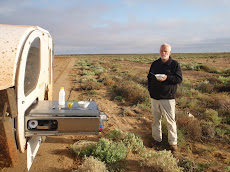
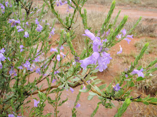
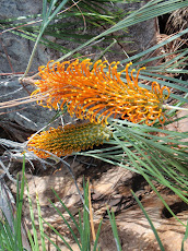
 Oh the Warrumbungles! 22 years ago we last visited these volcanic masterpieces when we were on our way to Brisbane for the 1988 Expo in Brisbane. That’s a reasonable amount of ageing. We left George’s place in Oberon fairly early on the 8th and made our way as far as a free camp spot on the Goulburn River between Ulan and Cassilis where there is a place euphemistically known as “The Drip”. All the locals used to Sunday there apparently, and as the pull off beside the bridge over the river looked attractive we thought “why not?” and set up for the night. The night was chilly but we had a good fire going, that re-kindled well the next morning with little coaxing. How Australian….”The Drip” .I had a mental picture of it that was only just sufficient to get the curiosity going; we set off next morning at first light on one of those enchanted river bank walks, with the sun’s rays boring through the canopy ahead and birds stirring and jostling for position. A short 1.4 kms later you find yourself hearing water, but not the gurgle of the river below you,.Instead around a bluff, you find yourself standing at the base of a long cliff face, perhaps 75 metres high and maybe 200 metres or so long. Dressed along the tiers created by the layers of rock overhead, long grasses and banks of ferns are bathed along the length of the cliff in a constant splash of water from the plateau above. The dripping is a grand affair. Wonderful understatement indeed.
Coonabarabran is east of the Warrumbungles, and south of The Pilliga, thousands of hectares of flat sandy and forested country that defeated explorer John Oxley when he attempted to cross through from the west, around the mid 1800s. We turned west there and drove the 25 kms to the Warrumbungles NP past Siding Springs, the optical telescope that still does a lot of useful work. The camp site was only at about 500 metres but we had our coldest night there and were very thankful for the sun next morning. Helen, bit between the teeth, persuaded me that the fourteen kilometres marked on the map (The Grand Tops) was a medium to gentle walk, the same one we had done in 1988. Easy peasy just lead the way. If I had looked more carefully at the blue piece of paper I would have registered that the walk takes you above 1100 metres and back down again to 500 in a short distance. But it didn’t matter because we had a real workout, taking the longer route home. The day was well spent by the time we drew breath again so we took off for the relative warmth of the caravan park at Coonabarabran, and put ourselves on the outside of the $8 steak at the bowling club…..with the local ladies practicing their line dancing for entertainment. Very good for the money really.

John, working the 3600 acres of sorghum, barley and cattle largely on his own, was very generous with his time; with two bulls to be tagged and a large paddock to burn to rid of unwanted grass after the sorghum was harvested; he needed help. As you move north things get larger, just as in the US, things grow when you move into Texas. Maybe the closeness of Texas NSW was having an effect. The point I am making is that the farm equipment is so big.
 John’s tractor is the size of a small house and I was a bit nervous when he handed me a pin with instructions to place it in the hitch. Calling down to me a floor below and with waving of hands he reversed the terraced tractor almost over me. I exaggerate but tell you what! Sue told me afterwards you always make up your mind where you’re going to jump before you start. Anyway, we hitched up a great rake and with us following in the ute, towing the fire trailer, we all took off to set fire to a few hundred acres. I understand those of you who know farming will know this stuff but to us it was an interesting experience to see. John opened up the harrow and drew bales of the errant grass into a thick heap. Leaping from the balcony of the tractor, clutching the can of diesel, John spread the fuel the 20 metre length of the implement and put the lot to the match. As the harrow travels on rubber tyred wheels a rapid return to the control room was required followed by a lurch forward, and the entire burning mass proceeded across the recently ploughed paddock at a stately 15 kph. We were detailed to follow the flank and be insurance. Easy work if you can get it!
 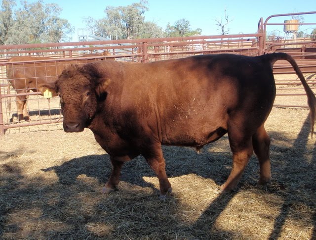 We could see that John had reservations about the task ahead of him with the bulls. South Devons are apparently polite and accommodating as bulls go, but John knew the race was narrower than they were. Getting them in was a lesson in how to persuade these great creatures to do something they know isn’t to their liking, in fact they simply did not fit in. But with some talking to with a whip crack they pushed and pushed with only a little tail twisting until they were utterly locked in – ready for another indignity! John’s description of the regulations for marking and tagging were interesting, and it seems there are bureaucracies wherever you turn. Thank you John and Sue for a fine spell with you.
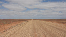
 Leaving latish in the morning we moved at a slow pace, for the first time having no clear destination ahead. It was a relief we both felt strongly and it has changed our perspective of the trip. As we look at the journeys travelled, marked in bright marker on our old and now tatty HEMA map book, we realize we were very much spurred on by the plan we had worked out before leaving home. Our travelling friends Max and Linda zig-zag across the countryside mostly regardless of any overall plan; and we have come to appreciate the advantage of being unencumbered that way. Start thinking about where the next night will be spent at about 2pm. Don’t travel faster than 80kph. Take the time to divert and look at the things mentioned in the tourist literature. Throw out the paperwork as you go – there’s an awful lot of it. So we will have to change the title of the blog because we ain’t gonna get to Cape York. It’ll keep.
With the farm stays behind us we spent a night at Cecil Plains on the Condamine River west of Toowoomba, pitched up next to a fine old homestead that turned out to be where the fascinating explorer Ludwig Leichhardt and his team set out from on the 1844 and 1847 explorations of western NSW and Queensland. Toowoomba tomorrow.


Dipping into your blog for the first time this trip - and as always most interesting and instructive. Off on our little adventure next week to SW France subject to us avoiding further volcanic ash!! Etchy
ReplyDeleteThat's a great photo of the burning acres - beautifully composed - it looks quite apocalyptic actually! I'm off to see if there's any more info about the slow cooled basalt cliffs in Auntie Helen's old geology stuff. So amazing. Love to you, folks, and happy bickering.
ReplyDeletei loved the writing about the burning acres and the Sawn Rocks are amazing. Love reading your blog... can picture it all (but not bickering?)
ReplyDelete